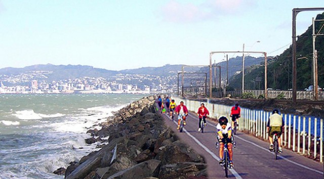
 Great Harbour WaySIMON EDWARDS - Hutt News | Wednesday, 23 July 2008
http://www.stuff.co.nz/dominionpost/4628174a24118.html
Cycle activated electronic warning signs are being considered for narrow sections of State Highway Two between Ngauranga and Petone.
Transit New Zealand regional manager Graham Taylor says the variable messages warning drivers there are cyclists ahead are activated when cyclists ride over loops on the side of the road.
Calls from cyclists and environmentalists for better safety for those on two wheels have intensified since the recent death of cyclists at Petone roundabout and Fergusson Drive Upper Hutt.
At a meeting earlier this month involving representatives of Cycle Aware Wellington (CAW), Greater Wellington Regional Council (GWRC) and Hutt City Council, ideas for reclamation of land between Korokoro Gateway and Ngauranga to create a wide, dedicated cycleway between the railway lines and harbour got another airing.
But Mr Taylor says "crude" estimates for such work put the cost at $10m-$15 million to reclaim enough land between Petone and Horokiwi (the start of the existing, relatively narrow cycleway) and as much as $40 million to do the whole length up to Ngauranga.
Mr Taylor told the Hutt News yesterday that Transit is soon to advertise for consultants to carry out thorough investigation of all future transport options in the 'Ngauranga Triangle' (Ngauranga/Tawa/Grenada/Petone/Ngauranga). That will include costing and investigating the practicability of reclaiming land and constructing a cycleway on the inland or seaward side of the railway tracks. That issue is allied with the call made in the 2006 Hutt Corridor Study for a dedicated HoT (high occupancy vehicle) lane for Petone-Ngauranga.
He was unable to say how long the study would take. "It depends on how many issues come up as we try to solve the problems."
But while that work goes on, he says there are shorter term measures that can be done to improve cyclists' safety. If the technology proves suitable, cycle-activated electronic warning signs in "pinch" places such as southbound under the Petone overbridge, and northbound where the road shoulder narrows past Horokiwi, could be in place within months.
Permanent warning signs to remind motorists to be aware of vulnerable cyclists will also form part of the strategy, but the risk is if they're always there are never change, they become environmental "wallpaper". Another suggestions is to paint green strips at the entry and exit points to the BP station on SH2 to remind turning motorists to keep an eye out for two-wheelers.
CAW secretary Alistair Smith applauds these measures but argues that long term, reclamation and a dedicated cycle lane is the way to go.
While "obviously expensive", reclaiming land has numerous potential spin-offs, including: encourage a rapid increase in the estimated 300-plus cyclists who 'commute' between Wellington and the Hutt each week; reduce the number of times the trains have to stop running because storms wash harbour water onto the tracks; and plug the most obvious hole in the much-vaunted, tourism and exercise-friendly 'Great Harbour Way' - a dedicated route for cyclists and walkers right around Wellington Harbour.
"It is ridiculous that we can't cycle and walk (safely) between the two biggest centres in the region.
"In places like Denmark and Sweden, which have similar population densities, putting in such a cycleway would be a no-brainer," Mr Smith says.
It could be a "magnificent" tourism asset, in the same way as Otago's popular Rail Trail.
And for those who blanch at talk of a $10m-$40m cost, Mr Smith's retort is to consider the cost of Transmission Gully in comparison.
GWRC councillors at a committee meeting last week were heartened that OnTrack are not totally adverse to the idea of cyclists crossing the railway tracks (with a suitable gate arrangement) where the current cycleway ends. That could link up with any new track on reclaimed land between Horokiwi and Petone.

Comments
There may be very simple
There may be very simple reasons making it impractical, but has there been consideration of an elevated cycleway along the seaward side of the rail track, single track each way, with passing lanes, built on piles above the level of wave damage?
I'm guessing that the huge cost estimate is a reflection of work likely to be necessary to prevent storm washouts.
I cycled on a long wooden track like that in California, built to protect a wetland/dune area.
Maybe it would cost as much as reclamation, but I suspect not.
If done in conjunction with work on the areas of rail-track most vulnerable to wave damage it could be useful to both.